

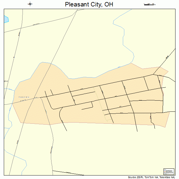
Pleasant City Ohio is located in Guernsey County Ohio. This county and town are located in the heart of Appalachian Ohio. The small city lies on a mostly flat area that is surrounded by rolling hills, and a small creek. The elevation of the small town is 823 feet above sea level. Pleasant City has only one water system that flows near it. Will’s Creek flows behind the small town. This small waterway is narrow, but this small creek is part of the Muskingum River a much larger more significant system. This large river is where the mouth of this creek is located, and flows through Guernsey County. The older houses of this small town are located near this waterway, and this system undoubtedly shaped why and where settlers broke ground. This lack of a major water why did have negative effects on the settlement. The lack of major waterways did prevent the town from growing sufficiently, and is one of the reasons why the town historically has had a small population. The current population is less than 500, and historically has not been much higher.
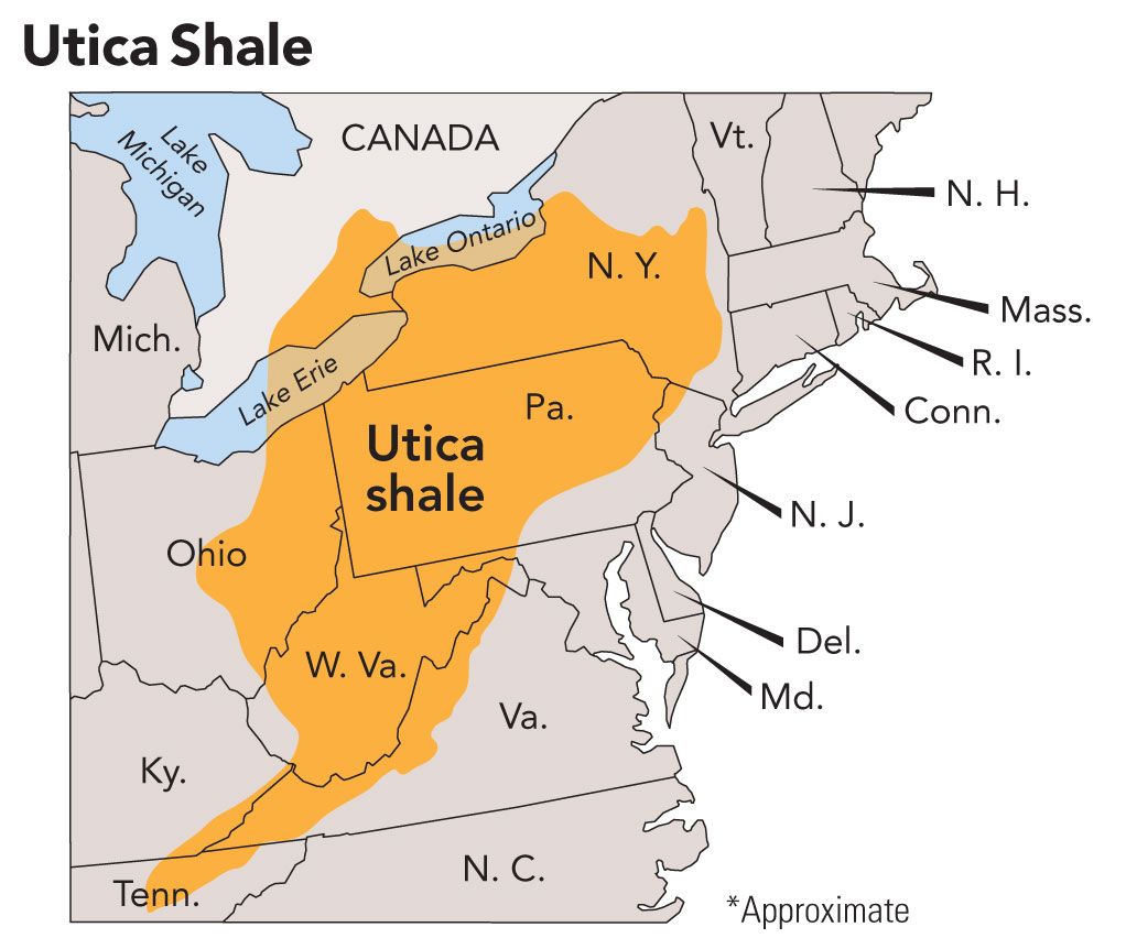
Guernsey County falls within the Utica Shale natural gas pocket. This pocket has directly impacted the small town since 2012. This year is when companies began buying land leases, and in the same year drilling began across the county close to the small town. This continued until the fall of gas prices in 2016. After this rapid fall much of the people associated with the industry have left the area, but are just recently beginning to return. This rapid discovery in 2012 led to an influx of new people who temporarily called the small town home. This greatly impacted the small town by adding new people to rent properties in and around the city. These changes led to economic growth in the region. This newly found economic growth did have social repercussions on the people who already lived in the town. Rent prices more than doubled in some instances, and prices of some goods did see a slight rise. This made life much harder for some people in the region, but many land owners did reap the substantial benefits of leasing their land to the oil companies. The rich endowment of fossil fuels in the region has been both a blessing and a curse this answer surely would change based on who you asked. The historical lack of natural resources up until now hampered the growth of Pleasant City, and explains its’ historically low population, and lack of growth. The town did house people in the 1800’s and early 1900’s that worked in the nearby coal towns of Derwent, Walhonding, and Kipling. Does the future hold serious potential for the town to grow and expand? The rumored return of the gas and oil industry bodes well for the town’s future, and might led to economic expansion in the town.
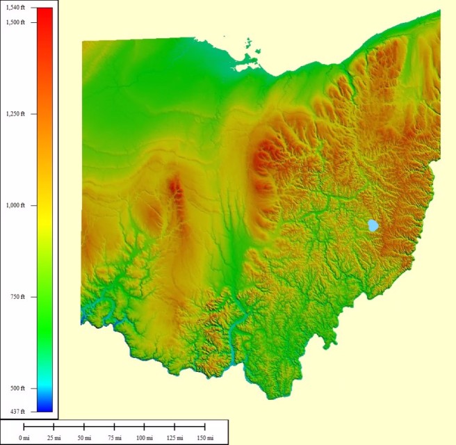
Pleasant City is located on the Alleghany Plateau of the Appalachian Mountains. This region stretches from New York to Kentucky. This plateau was created by the lack of glaciers in the region. The lack of glaciers greatly impacted the geography of Pleasant City and left alone the land that the city was build on, and the area around it. The lack of glaciers gave the area around the city rolling hills with peak and valleys on both sides. The town itself is built mostly on flat ground with some of the houses and buildings on the hill above the town. The town is surrounded by substantial amounts of plant and animal life. The lack of development has left much of the natural beauty near the town intact. The town could be used as a paradigm to describe many of the small rural towns in south eastern Appalachian Ohio.
photos from in order:
1. http://www.crosscountryroads.com/photos/ohio/oh-i77nb.html
3. http://topocreator.com/ned-jpg/atlas/600/oh.jpg
4. http://www.frackcheckwv.net/wp-content/uploads/2014/06/Utica-Shale-Map.jpg
