The History of Pleasant City


img_1080
St. Michael’s Catholic Church


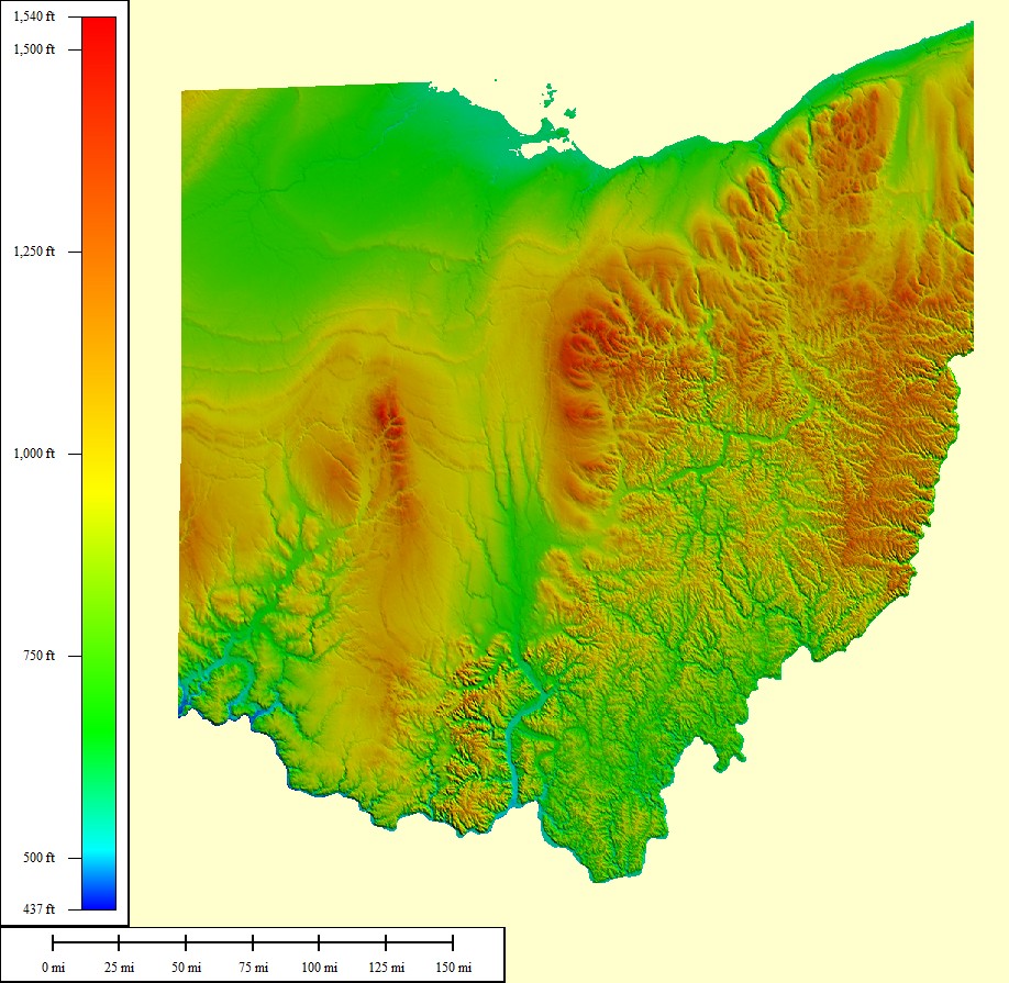
Pleasant City, Ohio lies in the hilly terrain of the Appalachian Mountains. The small town is located in Guernsey County, Ohio and is part of Valley Township the town was originally named Point Pleasant. Valley Township was founded in 1815 and the small town of Point Pleasant was founded in 1829. Before the town’s settlement the area was home to many different tribes of Native Americans, but after the formation of the Virginia Military white settlers came to the area in droves and pushed out the Natives. The town was founded mainly by French settlers and also a large number of Virginians who came from Irish and German decent. The town prospered during the age of the coal boom and the height of the reliance of railroads in the 1800’s. The town held steady into the 1950’s economically and then seen a rapid decline of economic activity after the 1960’s. The town currently has a population below 500 and there are not many businesses to be found in and around the city.


img_1102
Historic Sidewalk in Pleasant City


The hilly town of modern day Pleasant City was founded in 1829. The region offered fertile farmland for settlers and also had a source of power for mills with Will’s Creek nearby. Agriculture proved to be the main stable of Pleasant City’s economy up until the coal boom in the late 1800’s. The main part of the city was placed in a basin that is surrounded by hills and Will’s Creek. The historic core of the small town formerly known as Point Pleasant is still visible in the town today. The early settlers that originally came to the area traveled from Virginia mainly and also many settlers of the area came from France. The remnants of these early settlers are clearly visible in the town’s historic churches. The town features a Methodist for settlers with Irish descent who came from Virginia, a Catholic church for the Eastern European Catholics who migrated to the area during the coal boom, and finally two Lutheran churches for the German settlers. These settlers mainly farmed the area and made their living by doing so. The town then drastically changed in the later part of the 1800’s as the railroad boomed in the area and the local coal industry took off.


img_1096
Site of the old Bakery in Pleasant City


Pleasant City itself does not have rich natural resources, but nearby small towns in the area did. The small towns of Cumberland, Kipling, Derwent, and Walhonding all had sizeable coal mines with Cumberland having the largest deposit. The proximity of the coal industry to Pleasant City greatly impacted the economy of the small town and saw an influx of foreigners to the area. People from Eastern Europe flocked to the area in droves as the nearby coal industry spread. This caused significant changes in the city as more buildings became built to help accommodate the new workers. This also led to the construct of St. Michael’s Byzantine Church to help the new peoples find a place to worship. The coal boom in combination with the railroads saw the town move away from agriculture as farmers sought more profitable work in mines versus the daily toil of their land. Pleasant City reached the height of its prosperity as the ninetieth century came to pass thanks to the coal boom. The economy of the area remained steady until the end of the 1950’s and the population of the town remained steady. New industries appeared nearby and in the city itself. In nearby Ava a vital brickyard appeared, saw mills opened in nearby Chaseville, and the town even gained its own pop bottling company. The town in the late 1950’s had a bakery, laundromat, bank, bottling company, and many restaurants. The focus on farming further dissipated as the automobile became commonplace in the 1930’s and allowed workers to travel greater distances for new jobs. This prosperity came to a screeching halt as Interstate 70 became completed in the late 1960’s in the area.


img_1094
Old Store Front in Pleasant City


The construction of the highway system by the United States Government tore apart farms and harmed the rail industry. This coupled with the closing of coal mines around the area and the eventually closing of the Ava brickyard spelled doom for the small Appalachian town of Pleasant City. The Interstate divided farms and tore apart families in the area near Pleasant city. The lesser impact of the railroad harmed key industries around the city and saw many of them close their doors by the 1970’s. The town lost many of its shops and saw its population began to dip below 500 citizens. Key roads were destroyed that led to the sawmills in Chaseville by the Interstate and in the 1960’s the school in Pleasant City closed its doors as the area students became integrated into the newly formed schools of Meadowbrook and Shenandoah. The town still has yet to recover from these disastrous times. The town currently has around only 400 people in it and has only one seasonal restaurant compared to the multiple ones it possessed over 50 years ago. The main reasons why this rapid decline occurred are the negative impacts that the Interstate had on the area, the closing of key nearby industries, and the movement away from agriculture in the area.


img_1090
Another Site of a Former Shop in Pleasant City


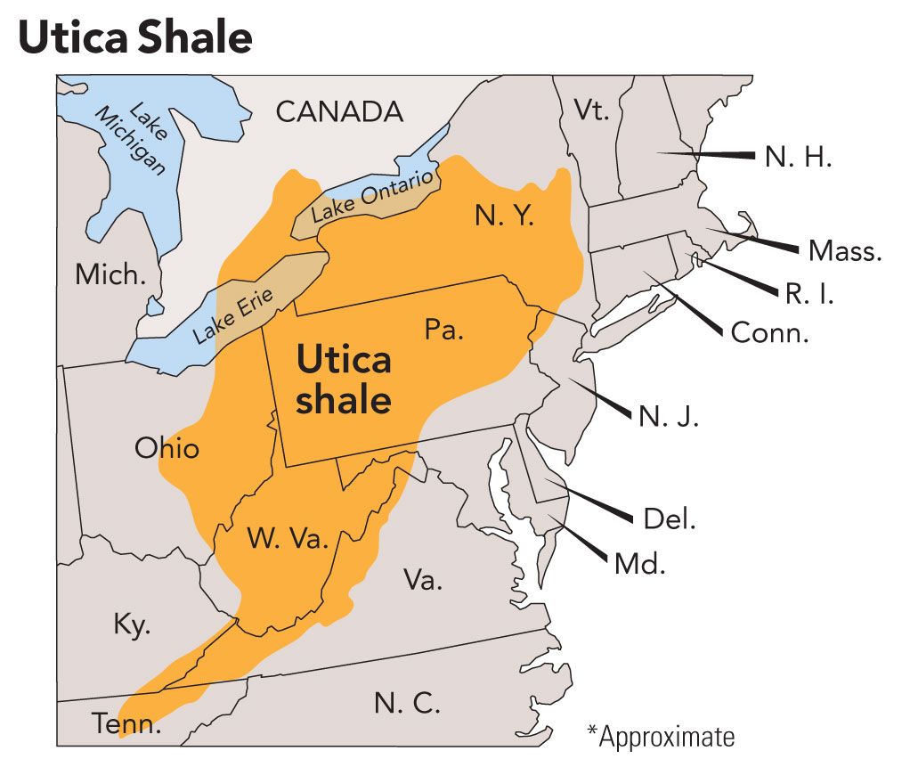
In conclusion, the best days are behind the small town of Pleasant City and there does not appear to be many solutions to help the small town grow again except for one realistic possibility. The moving of local industries overseas and to other regions of America has crushed Pleasant City and Guernsey County as a whole. This does not mean that as a resident of Pleasant that I am not proud of our past, but I hope that possibly a second oil boom occurs and this helps the small towns as it did in 2014, but only for a very short time. If the oil jobs come back in droves the small town can acquire funds to help it grow again. I am concerned for the future of my small town, but I will always have hope that we can turn it around and regain our lost prosperity.

Photos taken by Brett Lenarz

Sources: Colonel Cyrus P.B. Sarchet, History of Guernsey County, B.F. Brown & Company, Indianapolis, IN.

Pleasant City and the Automobile

pc
Exit to Pleasant City on I-70


The adoption of automobiles by many Americans after World War II greatly impacted the small town of Pleasant City, Ohio by altering its economy, changing the way new parts of the city were built, and dividing farms with the construction of I-70. The main focus of Pleasant City’s economy before the automobile was largely agriculture. The implementation of the automobile allowed for Pleasant City residents to seek employment in the nearby small towns of Cumberland, Ava, and Kipling. Residents traveled to Cumberland and Kipling to work in coal mines and to Ava to work in the brickyard. These new job opportunities led to a lesser focus on agriculture as more profitable jobs became attainable thanks to better transportation.

img_1102
Historic sidewalk in Pleasant City


The automobile also greatly impacted how the community built new sections of the city after World War II. The pre-WWII historic core of Pleasant City is easy to walk in and features mostly well kept sidewalks. The speed limit is a modest 20 miles per hour. Old shops, banks, and restaurants appear to have been easily accessible when they were open. The churches are easy to walk to and houses are well connected by sidewalks the core of the city is easy to access on foot because it was developed in a time where there were not automobiles and walking and horseback prevailed as the main sources of transportation. There is a large discrepancy between the layout of the historic core of Pleasant City and the newer section that is across Will’s Creek. The aforementioned features of the core of the city are mostly non-existent in the newer section. The houses in the newer section are still close together, but there are not sidewalks connecting the homes. The speed limit is 35 miles per hour, and places are not easy to get to on foot with the speeding cars that must be waited on before crossing the busy streets. This part of the city was built during the rise of the automobile and the design of this section clearly reflects the important changes it caused.

img_1093
Sidewalk in downtown Pleasant City


The noticeable impact that the automobile had on Pleasant City was the construct of Interstate 70 close to the small rural town. I-70 became completed near Pleasant City in the late 1950’s. The construction of this interstate system divided farms around the city as the U.S. Government  purchased the land for the Interstate. This along with aforementioned factors led to the decline of agriculture around Pleasant City. The Interstate greatly impacted the economy of nearby Buffalo as gas stations appeared at the exit near the city and helped give the small town an economic boost. Pleasant City on the other hand did not reap the benefits of the Interstate. The town’s economic core deteriorated in the 1960’s with the decline of the railroad and the closing of key nearby industries such as the brickyard at Ava. The Interstate further led to the downfall of agriculture around Pleasant City and contributed to the overall decline in prosperity of the small rural town.


img_1096
 The old Pleasant City Bakery


Photos from:

I-70

All others taken by Brett Lenarz

Information mostly from another interview with my grandfather.

Changes in Pleasant City


Jack Valentine

Born in 1947, Jack Valentine has spent his entire 69 year old life in Guernsey County Ohio. He is the son of a coal miner and has seen the drastic changes in Pleasant City since the 1950’s. Jack worked as a cement driver for over thirty years and is recently retired.

Brett: “What is your first memory of Pleasant City Ohio?”

Jack: “I suppose it’s of the Pleasant City Bottling Company, for their pop. That was their main source of income down there I suppose.”

Brett: “When did they do away with the bottling company?”

Jack: “That’s a good question. I don’t know when they went out of there. It would have been in the 60’s I suppose. Somewhere in the 60’s they went out of there. You might want to go to the library to figure that out.”

Brett: “What kind of pop did they bottle?”

Jack: “That was their name. They had their own name brand pop. They had their own orange pop, grape, and stuff like that. That’s what they had down there.”

Brett: “Do you remember there ever being a bank in Pleasant City?”

Jack: “Oh yeah, yep it was up there. The building I believe is still standing.”

Brett: “Is it the yellow building downtown?”

Jack: I don’t know I have no idea what color it is. I haven’t looked for years. If you are coming from your place and going down the main street it is on the right hand side. That is about where all of the businesses were down there. They had a restaurant and I don’t know the name of it either.”

Brett: “Do you remember there being any shops in Pleasant City?”

Jack: “They had a big Laundromat, a bakery, and I don’t know the names of any of them or who owned them or when they went in and when they went out. The restaurant lasted until the 70’s. I do know that. I was driving cement mixer when it was still there. That was in the 70’s.”

Brett: “Was there ever a school in Pleasant City?”

Jack: “Yep, right there where you go to that fork in the road. The fork goes up to the tire shop. That’s where the school house was. They had a high school and grade school for a long time. I don’t know where the other schools were.”

Brett: “Do you remember a lot of people living there because of the coal industry?”

Jack: “It was a booming place, but not like Caldwell or maybe Cambridge. It was as good as Byesville or Cumberland. Cumberland was a real small area they didn’t have any industry that I know of except for the coal mines. That’s where dad worked down there in Cumberland, in the strip mines.”

Brett: “So you would say the city used to be a lot bigger then it is now? A lot more happening?”

Jack: “Oh yes, yeah it was a pretty busy place. The railroad ran through there and I don’t know there was a good many bars down there to one on both sides of 821. I don’t ever remember there being a bar actually in town. I think they were out of the corporation limits. The bars weren’t in the limits of Pleasant City.

Brett: “Was there ever a sheriff’s department in Pleasant City?”

Jack: “No, I don’t believe there ever was any law enforcement down there. The closest station was in Byesville.”

Brett: “Did the dead-end road near my house used to be connected to Pleasant City?”

Jack: “Yeah, you could go right down that road and you would come out right there near the school house.”

Brett: “Why did they disconnect that road?”

Jack: “There wasn’t anything up there anymore. That used to be Chaseville up near where you lived, and that was a little bigger area. I mean there was some population their and that’s how that road stayed busy. There were big lumber yards, up there in Chaseville.

Brett: “What would you say the biggest chances to the city were?”

Jack: “When the mines slowed down, but that town slowed down before the mines did. The mines were still booming, but the railroad wasn’t busy. Also a lot of people in Pleasant City worked in Ava at the brickyard. That’s where a lot of the people that lived in Pleasant City worked. Not as much in the mines as you think they would have.”

Brett: So when the brickyard shut down people left the city?”

Jack: “Yeah, they shut down in the 60’s. In the 60’s they shut down the brickyard. A lot of people moved after that.”


How Guernsey County Remembers the Civil War

The remembrance of the Civil War in Pleasant City, Ohio is only visible in three small markers. The small Appalachian town has three markers that denote the path of John Hunt Morgan a Confederate General. The markers are part of the John Hunt Morgan Heritage Trails and were constructed in 2013. The trail has over 600 markers in Ohio and many of them are in Guernsey County. The signs are visible on Main Street in Pleasant City and stand alone by themselves with no other signs cluttered around them. These are the only current markers in the small town that are attached to the remembrance of the Civil War.

img_1131
Example of a Trail marker this one is on the outskirts of Pleasant City.


Brigadier General John Morgan Hunt began his daring raid in Tennessee June 11, 1863 and was captured in Northeastern Ohio July 26, 1863. Morgan served the Confederacy against the Union and he wanted to raid union territories to spread fear and terror among the citizens in the areas he raided. He also wanted to use his raids as a distraction that would help alleviate the pressure that Confederate forces faced elsewhere. He captured over 6,000 Union soldiers in his raid that covered over 1,000 miles in just 46 days. Morgan and his Raiders destroyed also destroyed over 34 bridges and disrupted the railroad in 60 places. Morgan also plundered many of the towns that he entered and stole anything from food to horses. Morgan and his Raiders did not plunder Pleasant City, but simply passed through the small town. While the Union captured Morgan, they had to call upon many of their forces to do this. The Union could have used these forces elsewhere in the war. Morgan terrorized Union territories and damaged vital transportation routes. While his raid caused terror in the North, the Union recovered from it quickly and won the war almost two years later.

Ohio_Raid_Map
Map of Morgan’s Raid


The fact that this event is remembered favorably in states that sided with the Union is astonishing to me. The way that this event is remembered falls into the “Lost Cause” category of ways that the Civil War is remembered. This type of Civil War remembrance ignores the issue of slavery and views the Confederacy as the underdog in the war and claims that they faced a much more powerful foe in the Union. This type of remembrance focuses on the natural beauty of the South and views Confederate soldiers as heroic. In reality, the Union faced a much harder goal than the South did in the Civil war. The “Lost Cause” way of remembering the civil war is wrong for it makes false claims about the odds that the South faced and it also completely ignores slavery as a cause for the war.

johnhuntmorgan1
Confederate Brigadier General John Hunt Morgan


Guernsey contributed heavily to the war effort for the Union. The small county gave the Union Army over 2,000 soldiers. Out of the 2,000 men chosen to fight 15 of them came from Valley Township the township where Pleasant City is currently located. Not all of the citizens from Guernsey County agreed with the war and this can be seen in way that many of the citizens treated John Morgan when he arrived in the area. Many of the citizens welcomed him with open arms and helped feed him and his men. This is one of the reasons why the “Lost Cause” mentality still persists in Guernsey County and particularly in the small mostly white town of Pleasant City. Cambridge the largest city in the county remembers the war more along the lines of the “Union Cause” and still mostly ignores slavery, the root of the war. The positive view of John Morgan and his Raid is wrong and I feel that having a trail to honor him for stealing and terrorizing innocent people is morally unacceptable.

9926429
Cambridge’s Civil War Statue
55fd2b75d5656139896ead39b115b737
The text says: Dedicated to the memory of the men from Guernsey County who served in the defense of their country in the war against the rebellion

Photos from in order: Taken by Brett Lenarz the Morgan Marker the rest are from as follows in order of appearance.

Morgan’s Raid

John Hunt Morgan

Full picture of statue

Picture of statue text

Sources for information : Colonel Cyrus P.B. Sarchet, History of Guernsey County, B.F. Brown & Company, Indianapolis, IN.

The People Who Founded Pleasant City

Pleasant City is in Guernsey County, Ohio and is located in Valley Township. French settlers helped to find the township and Peter D. Robins of France was one of the first founders of the area. His parents lived in Wheeling, West Virginia and he moved from there to modern day Pleasant City. Robins represented a minority as the majority of the people who helped find Point Pleasant now Pleasant City came from Virginia. Benjamin Wilson founded Point Pleasant in 1829. He like many of the first settlers of the area came from Virginia. The ancestry of these Virginians were predominately from Ireland, out of the 59 people who lived in and around Valley Township in 1850 47 of them came from Ireland. The area also included a small British population of 7 people and a German population of 3. The remaining two people came from France. The early dominance of Virginians with Irish ancestry is abundantly clear even today. One of the oldest churches in the town is Pleasant City is a Methodist Church. The church remains in the downtown sector of the small city and still serves the community.

img_1084
Methodist church in Pleasant City

The influx of Virginians also helped give Pleasant City its well organized downtown. The downtown area is dominated by churches, the local post office, and former shops and banks. The downtown area fallows a mostly rectangular pattern. The major street names in the downtown area are Main, High, Maple, Elm, Walnut, and Orchard. These street names are common across America and are not unique to Pleasant city. This is another sign of the practicality of the Virginians who helped find the city in the early 1800’s. The town’s build becomes much more organic as it spreads out and this is a sign of the influx of Germans and Eastern Europeans that came to the area in the mid and late 1800’s as part of the coal boom in the area. Many of the Germans also came to farm around the city. This influx of newcomers created a new demand for more spiritual centers in and around the city.

river
The orderly build of Pleasant City
img_1089
The orderly design of the town

The strong presence of Eastern Europeans led to the construction of St. Michaels Byzantine Catholic Church on June 24, 1848. The large brick Church stands high upon a hill and towers over any other building in Pleasant city. It is still the distinguishing feature for the small town and a sense of pride for the small community. The majority of the Eastern Europeans who helped create the large church came to the region as a part of the coal boom in the 1800’s. They came from diverse backgrounds with many of them coming from Czechoslovakia, Hungary, and Russia. The left section of the town is home to many current families with Eastern European origins.

img_1081
St. Michael’s Byzantine Catholic church in Pleasant City

The most prevalent religion in the small town is not Eastern Orthodox or Methodist, it is Lutheran. Many Germans moved to the town after the 1850’s as a part of the coal boom. They also moved to the region to find fertile land to establish farms. The influx of Germans led the citizens of Pleasant City to construct not one but two Lutheran Churches in and around the city. These German immigrants established St. Paul’s Lutheran church on April 1, 1864 in the downtown part of the city. This church served the farmers of the area who practiced the Lutheran faith. The second Lutheran church is located about three miles outside of the side on top of Mt. Zion hill. This small church served the Lutheran coal workers who came to the town to find prosperity. Both Lutheran Churches still serve people in and around the city.

Sources: Colonel Cyrus P.B. Sarchet, History of Guernsey County, B.F. Brown & Company, Indianapolis, IN.

Immigration by County

Photos all taken by Brett Lenarz except for the map of Pleasant City

Map from:

Pleasant City Map


The Shape of Valley Township


united_states_military_district_map
United States Military District Location in Ohio


         Guernsey County belonged to Washington County up until 1788 and did not become a county until 1815. Valley Township is the township where Pleasant City is located and is in Guernsey County. The township is 522 square miles. Guernsey County belonged to the United States Military District. This district is over 2.5 million acres of land and was given to veterans of the Revolutionary War. The United States issued this land as a way to compensate veterans who helped win American independence. The Revolutionary War put the United States into deep debt and the new country did not have the money to compensate veterans. The United States owed large sums of money to the French Government. The French decided to support the Colonists in the Revolutionary War and their support proved to be vital. The Colonists would have found it difficult to stymie the British Army without French support. The government decided to compensate some of the soldiers with land west of the Ohio River in lieu of cash payments for their service. 

180px-map_of_ohio_highlighting_guernsey_county-svg
Guernsey County


         The United States Military District included land in the modern-day Noble, Guernsey, Tuscarawas, Muskingum, Coshocton, Holmes, Licking, Knox, Franklin, Delaware, Morrow, and Marion Counties. Ohio featured many other sections and the United States Military District is located in the center and eastern part of the state. The boundaries of the district were to start at the northwest corner of the Seven Ranges, now known as the Seven Ranges Terminus then proceed 50 miles south along the west edge of the Seven Ranges then proceed due west to the Scioto River then up the Scioto River to the Greenville Treaty Line then northeast along the Greenville Treaty Line to Fort Laurens then up the Tuscarawas River to a point west of the Seven Ranges Terminus, then east to the point of beginning. This large area was then dived into counties at a later date.

valley-township
Valley Township’s Location in Guernsey County


         Pleasant City is in one of the southernmost points of Guernsey County and borders the Seven Ranges. The area is hilly and does not possess much flat land for a large settlement. This is the reason why Valley Township even today does not have a large town. The settlements in this area are classified as villages. The population in this area is also low compared with the rest of the county. The United States Government decided to allocate land based on the rank of the soldiers. Higher ranking officers received large bounties of land. The government entitled Major Generals 1,100 acres, Brigadier Generals 850 acres, and Colonels 500 acres of land. Lower ranking soldiers such as Ensigns received 150 acres and Non-Commissioned Officers received 100 acres. These men took this land as an opportunity to start a new life in a new mostly unsettled land. The work to settle the heavily wooded area proved to be arduous, but this new territory offered rich natural resources such as plentiful game and Valley Township later proved to be rich in earth minerals such as coal. Will’s creek also offered an opportunity to use the flowing body of water as a source of power for mills.

         Valley Township as mentioned before was settled in 1815 and is at the southernmost part of Guernsey County. Surveyors designed the Township in the shape of the letter L due to Will’s Creek. The original survey consisted of only 21 large sections. The predominant settlers of this area came from Virginia and France. Virginians founded Point Pleasant and the citizens of this small village later renamed it Pleasant City. Settlers did not include Valley Township in the original townships of Guernsey County. The settlement is almost in the Seven Ranges and is just at the border.    

Sources: Colonel Cyrus P.B. Sarchet, History of Guernsey County, B.F. Brown & Company, Indianapolis, IN.

Photos From in Order:

United States Military District

Guernsey County

Valley Township


The Impact of the Fish Basket on Natives Who Lives Near Pleasant City

fish
Example of a Native Fish Basket

Pleasant City is located in Guernsey County Ohio. White settlers founded Guernsey County January 31, 1810. The village of Point Pleasant was founded in 1829 and later renamed Pleasant City by the citizens of the town. When white settlers founded the County they encountered a sparse Native American population. William Wolfe ascertained the topography of the county made it unattractive for a large Native settlement. Guernsey County features many rolling hills which made it hard for Natives to develop a large settlement in the area. The neighboring counties possessed many of the larger local settlements. These counties included Muskingum, Noble, and Tuscarawas. Guernsey County did play a major role in the lives of the Natives despite the lack of flat building ground. The Natives used the winding creeks and rolling hills to hunt and fish for the valuable game the County offered. Will’s Creek proved to be an important waterway for Native Fishermen.

180px-map_of_ohio_highlighting_guernsey_county-svg
Guernsey County

When white settlers arrived in Guernsey County the area featured a diverse mix of Native tribes. Colonel Cyrus P.B. Sarchet recalled that the population included Delawares, Shawnees, Senecas, and Mingos. The upheaval of Native peoples from their homelands was on full display when whites founded Guernsey County. The mixture of tribes is evidence of the profound impact that white settlement had on Native tribes. Unlike neighboring counties, Guernsey County does not have many confirmed artifacts of Native peoples. The confirmed findings do include arrowheads and fishing baskets. This evidence backs the claim that the region proved to be an important hunting and fishing ground for Native peoples.

The fishing basket proved to be an invention that saw much use in Guernsey County and near the location of the modern day Pleasant City. The fishing basket was a device for catching fish in great quantities. The Native peoples could easily construct these devices and they would yield large amounts of fish. The Natives would locate the basket at a wide place in a stream where the water was shallow and in a spot that had a constant current. They constructed two walls of loose stone towards the center of the stream, each placed at an angle. The walls would be pointed downstream and would come together at the center, thus forming an apex.  Below this gap is where the Natives placed the basket. This was an enclosure several feet in diameter, made by driving large stakes into the bed of the stream they were placed close together and this made sure that fish did not escape.

The examples left show us how easy it was to catch fish using this clever device.  When fish swam down the stream, they would come to the wall, between the loose stones of which the water could flow but the fish could not pass through the net. Their progress downstream would be obstructed by the stakes. They could turn around and swim out through the opening they came in, but that was neither their nature nor the way they wanted to go. At certain seasons of the year, the fish would fill the enclosure within a very short time. The owners of a fish basket would empty it frequently when the season supplied much fish. The bend in Will’s Creek near Pleasant city would have been an opportune spot for Native fisherman to rig this effective device.

river
Map of Modern Day Pleasant City With Will’s Creek Behind the City

The abundance of the natural game proved to be vital to the survival of Native peoples who lived near or in Guernsey County. While the hilly landscape did not allow the Natives to construct a large settlement in Guernsey County the deer, squirrels, rabbits, fish, and other animals that inhabited the area allowed them to survive. The game also played a vital role in the survival of the white settlers who usurped the Native Americans who once called Guernsey County home. In conclusion, while many people do not feel a strong Native presence in the County, it is easy to find small artifacts that symbolize the way of Native life in Guernsey County before white settlers.

arrow
Arrowhead Found in Guernsey County

Sources: Colonel Cyrus P.B. Sarchet, History of Guernsey County, B.F. Brown & Company, Indianapolis, IN.

William Wolfe, Stories of Guernsey County.

Images from in order:

https://www.google.com/search?sa=G&hl=en&q=native+american+fish+trap&tbm=isch&tbs=simg:CAQSlQEJxiA35TXL4JYaiQELEKjU2AQaAggCDAsQsIynCBpiCmAIAxIowAueGawVwQuBDJ0Z8BauDoMEtQv3N-w37zenN-03kyneKNsooSj4NxowhIbsZIDMiRXMRtXxFzMsyn4YypcgGObgf_1NclcrtY0-BzqSCJdVpAHvLRqXTAxJxIAQMCxCOrv4IGgoKCAgBEgRhyL3cDA&ved=0ahUKEwiNt8bL9_HRAhUJhlQKHWFXANQQwg4IGSgA&biw=1920&bih=925#hl=en&tbm=isch&q=native+american+fish+trap&imgrc=_GY4WcAVjPKJ2M:

https://www.google.com/search?q=guernsey+county&espv=2&biw=1920&bih=925&source=lnms&tbm=isch&sa=X&ved=0ahUKEwjTvNis-PHRAhWiilQKHQtlAbgQ_AUICSgE#imgrc=lm5zNa0ErB_lQM:

https://www.google.com/maps/place/Pleasant+City,+OH+43772/data=!4m2!3m1!1s0x8837cc915a384193:0x1d24c3abc81df9fa?sa=X&sqi=2&ved=0ahUKEwitoO3N3szRAhXollQKHTGwC_MQ8gEIajAK

https://www.google.com/search?q=arrowhead+in+guernsey+county&espv=2&biw=1920&bih=925&source=lnms&tbm=isch&sa=X&ved=0ahUKEwjN94_Q-PHRAhWhi1QKHewvBPoQ_AUICCgD#imgrc=jY3j6fpca6b-nM:

Appalachian Geography

pc

river

Pleasant City Ohio is located in Guernsey County Ohio. This county and town are located in the heart of Appalachian Ohio. The small city lies on a mostly flat area that is surrounded by rolling hills, and a small creek. The elevation of the small town is 823 feet above sea level. Pleasant City has only one water system that flows near it. Will’s Creek flows behind the small town. This small waterway is narrow, but this small creek is part of the Muskingum River a much larger more significant system. This large river is where the mouth of this creek is located, and flows through Guernsey County. The older houses of this small town are located near this waterway, and this system undoubtedly shaped why and where settlers broke ground. This lack of a major water why did have negative effects on the settlement. The lack of major waterways did prevent the town from growing sufficiently, and is one of the reasons why the town historically has had a small population. The current population is less than 500, and historically has not been much higher.

oh_li_moment
Approximate location of pleasant City on a altitude map

Guernsey County falls within the Utica Shale natural gas pocket. This pocket has directly impacted the small town since 2012. This year is when companies began buying land leases, and in the same year drilling began across the county close to the small town. This continued until the fall of gas prices in 2016. After this rapid fall much of the people associated with the industry have left the area, but are just recently beginning to return. This rapid discovery in 2012 led to an influx of new people who temporarily called the small town home. This greatly impacted the small town by adding new people to rent properties in and around the city. These changes led to economic growth in the region. This newly found economic growth did have social repercussions on the people who already lived in the town. Rent prices more than doubled in some instances, and prices of some goods did see a slight rise. This made life much harder for some people in the region, but many land owners did reap the substantial benefits of leasing their land to the oil companies. The rich endowment of fossil fuels in the region has been both a blessing and a curse this answer surely would change based on who you asked. The historical lack of natural resources up until now hampered the growth of Pleasant City, and explains its’ historically low population, and lack of growth. The town did house people in the 1800’s and early 1900’s that worked in the nearby coal towns of Derwent, Walhonding, and Kipling. Does the future hold serious potential for the town to grow and expand? The rumored return of the gas and oil industry bodes well for the town’s future, and might led to economic expansion in the town.utica-shale-map_li

Pleasant City is located on the Alleghany Plateau of the Appalachian Mountains. This region stretches from New York to Kentucky. This plateau was created by the lack of glaciers in the region. The lack of glaciers greatly impacted the geography of Pleasant City and left alone the land that the city was build on, and the area around it. The lack of glaciers gave the area around the city rolling hills with peak and valleys on both sides. The town itself is built mostly on flat ground with some of the houses and buildings on the hill above the town. The town is surrounded by substantial amounts of plant and animal life. The lack of development has left much of the natural beauty near the town intact. The town could be used as a paradigm to describe many of the small rural towns in south eastern Appalachian Ohio.

photos from in order:

1. http://www.crosscountryroads.com/photos/ohio/oh-i77nb.html

2. https://www.google.com/maps/place/Pleasant+City,+OH+43772/data=!4m2!3m1!1s0x8837cc915a384193:0x1d24c3abc81df9fa?sa=X&sqi=2&ved=0ahUKEwitoO3N3szRAhXollQKHTGwC_MQ8gEIajAK

3. http://topocreator.com/ned-jpg/atlas/600/oh.jpg

4. http://www.frackcheckwv.net/wp-content/uploads/2014/06/Utica-Shale-Map.jpg